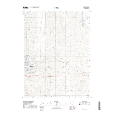
2018 Map of Glenwood
USGS Topo · Published 2018About this map
Glenwood serves as the primary hub of this Iowa landscape, characterized by the winding paths of Keg Creek and Waubonsie Cr through the loess hills of Mills County. The map provides significant detail for genealogists, identifying several small burial grounds such as the Somar Family on Wright Farm Cem and the County Farm Cem. The settlement pattern follows a grid of county roads, with smaller communities like Silver City to the north and the hamlets of Hillsdale and Balfour punctuating the agricultural terrain. The presence of the State Cem and Glenwood Cem within the seat of Glenwood highlights the area's long-established local history and institutional roots. Waterways like Silver Creek define the eastern boundaries of this prairie-land survey, showing how the natural drainage shaped the placement of early townships and rail corridors.
Find a feature on this map
82 named features on this map. Tap any name to fly to it.
Don’t see what you’re looking for? This feature index may not catch every label — zoom into the map to look around manually.
Map Details
Editions of this 2018 Glenwood Map
This is the sole edition of this map. No revisions or reprints were ever made.
Other maps of this area

1935 · Nehawka
USGS Topo · 1:48,000

1940 · Nehawka
USGS Topo · 1:62,500

1954 · Omaha
USGS Topo · 1:250,000

1955 · Nebraska City
USGS Topo · 1:250,000

1956 · Glenwood
USGS Topo · 1:24,000

1956 · Mineola
USGS Topo · 1:24,000

1956 · Rock Bluff
USGS Topo · 1:24,000

1956 · Pacific Junction
USGS Topo · 1:24,000

1956 · Treynor
USGS Topo · 1:24,000

1956 · Council Bluffs South
USGS Topo · 1:24,000