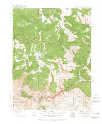
1927 Map of Glenwood Springs
USGS Topo · Published 1967About this map
Glenwood Springs serves as the focal point of this 1920s survey, situated at the confluence of the Colorado River and the Eagle River. The map reveals a landscape defined by the dramatic transition from the canyon floors to the high elevations of the White River Plateau and the Flat Tops. The industrial footprint of the era is evident along the river corridor, specifically at the Shoshone Power Plant and the mining-adjacent tracks of the Denver and Rio Grande Western railroad.
Find a feature on this map
93 named features on this map. Tap any name to fly to it.
Don’t see what you’re looking for? This feature index may not catch every label — zoom into the map to look around manually.
Map Details
Editions of this 1927 Glenwood Springs Map
3 editions found
Other maps of this area

1906 · Grand Hogback
USGS Topo · 1:125,000

1909 · Mount Jackson
USGS Topo · 1:125,000

1910 · Danforth Hills
USGS Topo · 1:125,000

1910 · Grand Hogback
USGS Topo · 1:125,000

1911 · Mount Jackson
USGS Topo · 1:125,000

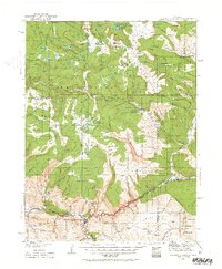
1927 · Glenwood Springs
USGS Topo · 1:125,000

1930 · Glenwood Springs
USGS Topo · 1:125,000

1954 · Craig
USGS Topo · 1:250,000

1957 · Craig
USGS Topo · 1:250,000

1957 · Leadville
USGS Topo · 1:250,000