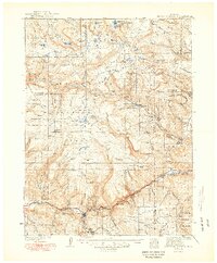
1930 Map of Glenwood Springs
USGS Topo · Published 1949About this map
Glenwood Springs serves as the focal point for this survey, situated at the junction where the Roaring Fork River meets the Colorado River. The landscape is dominated by the high-elevation White River Plateau, a complex wilderness defined by deep canyons and prominent peaks like Shingle Pk and Sheep Mtn. The Denver and Rio Grande Western Railroad follows the rugged course of the Colorado River through the Glenwood Canyon area, passing the industrial Shoshone Power Plant and reaching the small settlement of Dotsero.
Find a feature on this map
89 named features on this map. Tap any name to fly to it.
Don’t see what you’re looking for? This feature index may not catch every label — zoom into the map to look around manually.
Map Details
Editions of this 1930 Glenwood Springs Map
4 editions found
Other maps of this area

1906 · Grand Hogback
USGS Topo · 1:125,000

1909 · Mount Jackson
USGS Topo · 1:125,000

1910 · Danforth Hills
USGS Topo · 1:125,000

1910 · Grand Hogback
USGS Topo · 1:125,000

1911 · Mount Jackson
USGS Topo · 1:125,000

1927 · Glenwood Springs
USGS Topo · 1:125,000

1930 · Glenwood Springs
USGS Topo · 1:125,000

1954 · Craig
USGS Topo · 1:250,000

1957 · Craig
USGS Topo · 1:250,000

1957 · Leadville
USGS Topo · 1:250,000