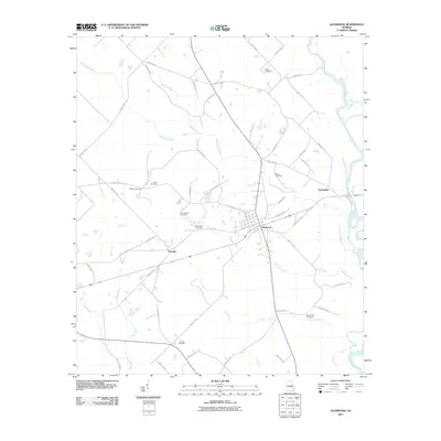
2011 Map of Glenwood
USGS Topo · Published 2011About this map
Glenwood serves as the central hub of this South Georgia landscape, where a grid of local streets meets the rail corridor and major state routes. The area is defined by its numerous family and community burial grounds, such as Baker Cemetery, Jones Cemetery, and New Stuckey Cemetery, which offer valuable coordinates for genealogical research in Wheeler County. The terrain is a network of watercourses, with Ochwalkee Creek and Peterson Creek draining toward the eastern boundary marked by the Oconee River. Small settlements like Stuckey and Ochwalkee punctuate the rural sections, connected by an extensive system of county roads. The mapping of Larry Creek and Bear Creek further illustrates the drainage patterns that have historically shaped land use and agricultural development in this region.
Find a feature on this map
57 named features on this map. Tap any name to fly to it.
Don’t see what you’re looking for? This feature index may not catch every label — zoom into the map to look around manually.
Map Details
Editions of this 2011 Glenwood Map
This is the sole edition of this map. No revisions or reprints were ever made.
Other maps of this area

1957 · Macon
USGS Topo · 1:250,000

1958 · Macon
USGS Topo · 1:250,000

1964 · Macon
USGS Topo · 1:250,000

1970 · Scotland
USGS Topo · 1:24,000

1970 · Glenwood
USGS Topo · 1:24,000

1970 · Alamo
USGS Topo · 1:24,000

1970 · Mount Vernon
USGS Topo · 1:24,000

1970 · Uvalda
USGS Topo · 1:24,000

1970 · Jordan
USGS Topo · 1:24,000

1971 · Soperton South
USGS Topo · 1:24,000