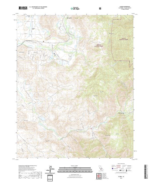
2021 Map of Globe
USGS Topo · Published 2021About this map
Springville serves as a focal point for this region of the Sierra Nevada foothills, where the Tule River and its various agricultural irrigation systems, such as the Moore-Witt Ditch and Graham-Osborn Ditch, define the local landscape. The map captures a complex network of canyons and high-elevation flats, including Ward Canyon and Joaquin Flat, illustrating the transition from foothill settlements like Big Campbell to the protected wildlands of the Sequoia National Forest.
Find a feature on this map
53 named features on this map. Tap any name to fly to it.
Don’t see what you’re looking for? This feature index may not catch every label — zoom into the map to look around manually.
Map Details
Editions of this 2021 Globe Map
This is the sole edition of this map. No revisions or reprints were ever made.
Other maps of this area

1904 · Kaweah
USGS Topo · 1:125,000

1909 · Kaweah
USGS Topo · 1:125,000

1936 · White River
USGS Topo · 1:62,500

1936 · Tobias Peak
USGS Topo · 1:125,000

1937 · Kaweah
USGS Topo · 1:125,000

1943 · Tobias Peak
USGS Topo · 1:125,000

1945 · Tobias Peak
USGS Topo · 1:62,500

1948 · Bakersfield
USGS Topo · 1:250,000

1948 · Fresno
USGS Topo · 1:250,000
1952 · White River
USGS Topo · 1:62,500