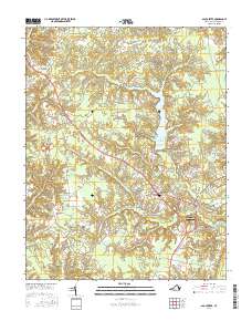
2016 Map of Gloucester
USGS Topo · Published 2016About this map
Gloucester Courthouse serves as the focal point of this Virginia landscape, where the colonial-era settlement patterns of the Middle Peninsula meet modern conservation efforts. The central portion of the map is dominated by the Beaverdam Swamp Reservoir, a large body of water that follows the dendritic fingers of the Beaverdam Swamp through the surrounding coastal plain. Local history is deeply etched into the land at sites like Old Bellamy Cem near Bellamy and the Newington Cem situated just outside the main village. The transition from the rural crossroads of Woods Crossroads to the more densely settled corridors around Edgehill illustrates the ongoing growth of this historic county seat. This survey captures a terrain defined by slow-moving waterways such as Fox Mill Run and Woods Mill Swamp, which long dictated the placement of early farms and transportation routes like Fiddlers Bridge.
Find a feature on this map
157 named features on this map. Tap any name to fly to it.
Don’t see what you’re looking for? This feature index may not catch every label — zoom into the map to look around manually.
Map Details
Editions of this 2016 Gloucester Map
This is the sole edition of this map. No revisions or reprints were ever made.
Other maps of this area

1906 · Williamsburg
USGS Topo · 1:62,500

1916 · Kilmarnock
USGS Topo · 1:48,000

1916 · Mathews
USGS Topo · 1:62,500

1917 · Urbanna
USGS Topo · 1:62,500

1917 · Kilmarnock
USGS Topo · 1:62,500

1917 · Mathews
USGS Topo · 1:62,500

1942 · Kilmarnock
USGS Topo · 1:62,500

1943 · Richmond
USGS Topo · 1:250,000

1948 · Ware Neck
USGS Topo · 1:24,000

1948 · Achilles
USGS Topo · 1:24,000