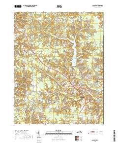
2019 Map of Gloucester
USGS Topo · Published 2019About this map
The Gloucester County Courthouse serves as the focal point for this Tidewater Virginia landscape, where the historic seat of Gloucester sits at the junction of the region's modern road network and its ancient swamp systems. To the north, the Beaverdam Swamp Reservoir dominates the drainage of Beaverdam Swamp, a massive hydrologic feature that transitions into tidal creeks like Wilson Cr and Carter Cr as the land slopes toward the Chesapeake tributaries.
Find a feature on this map
150 named features on this map. Tap any name to fly to it.
Don’t see what you’re looking for? This feature index may not catch every label — zoom into the map to look around manually.
Map Details
Editions of this 2019 Gloucester Map
This is the sole edition of this map. No revisions or reprints were ever made.
Other maps of this area

1906 · Williamsburg
USGS Topo · 1:62,500

1916 · Kilmarnock
USGS Topo · 1:48,000

1916 · Mathews
USGS Topo · 1:62,500

1917 · Urbanna
USGS Topo · 1:62,500

1917 · Kilmarnock
USGS Topo · 1:62,500

1917 · Mathews
USGS Topo · 1:62,500

1942 · Kilmarnock
USGS Topo · 1:62,500

1943 · Richmond
USGS Topo · 1:250,000

1948 · Ware Neck
USGS Topo · 1:24,000

1948 · Achilles
USGS Topo · 1:24,000