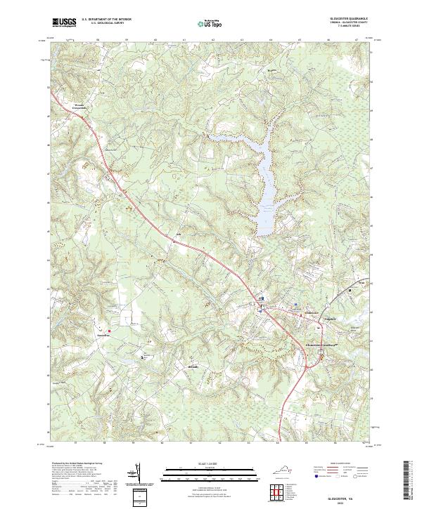
2022 Map of Gloucester
USGS Topo · Published 2022About this map
Gloucester Courthouse serves as the focal point of this coastal Virginia landscape, where modern road networks intersect with a settlement pattern established centuries ago. The central prominence of the Gloucester County Courthouse and surrounding community of Edgehill highlights the area's role as a civic hub, while smaller hamlets like Woods Crossroads, Sassafras, and Bellamy define the surrounding rural character. The terrain is deeply influenced by its proximity to the Chesapeake Bay, carved by numerous water bodies including Beaverdam Swamp, Crany Cr, and Fox Mill Run. For genealogists and local historians, the placement of the Old Bellamy Cem, Newington Cem, and Ware Cem provides essential points for family research. The extensive Beaverdam Swamp Reservoir dominates the northern reaches, illustrating how natural drainage systems have been managed for regional water needs while maintaining the distinctive low-lying topography of Cowpen Neck and Deacons Neck.
Find a feature on this map
154 named features on this map. Tap any name to fly to it.
Don’t see what you’re looking for? This feature index may not catch every label — zoom into the map to look around manually.
Map Details
Editions of this 2022 Gloucester Map
This is the sole edition of this map. No revisions or reprints were ever made.
Other maps of this area

1906 · Williamsburg
USGS Topo · 1:62,500

1916 · Kilmarnock
USGS Topo · 1:48,000

1916 · Mathews
USGS Topo · 1:62,500

1917 · Urbanna
USGS Topo · 1:62,500

1917 · Kilmarnock
USGS Topo · 1:62,500

1917 · Mathews
USGS Topo · 1:62,500

1942 · Kilmarnock
USGS Topo · 1:62,500

1943 · Richmond
USGS Topo · 1:250,000

1948 · Ware Neck
USGS Topo · 1:24,000

1948 · Achilles
USGS Topo · 1:24,000