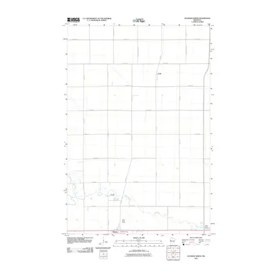
2010 Map of Glyndon North
USGS Topo · Published 2010About this map
The Buffalo River meanders through the flat agricultural expanse of Clay County, anchoring the landscape between the settlements of Glyndon and Averill. This 2010 survey shows the section line road network that defines the region's rural character, including County Hwy-104 and 100th Ave N. Along the southern edge, the Glyndon Post Office serves the local community, while the Riverside Cemetery sits near a prominent bend in the river. Unique local landmarks like the Offutt Farm Airport and the Buffalo River Speedway illustrate the diverse land use in this part of Minnesota, where traditional farming infrastructure meets modern recreational and transportation needs.
Find a feature on this map
24 named features on this map. Tap any name to fly to it.
Don’t see what you’re looking for? This feature index may not catch every label — zoom into the map to look around manually.
Map Details
Editions of this 2010 Glyndon North Map
This is the sole edition of this map. No revisions or reprints were ever made.
Other maps of this area

1895 · Fargo
USGS Topo · 1:125,000

1897 · Fargo
USGS Topo · 1:125,000

1918 · Ulen
USGS Topo · 1:62,500

1919 · Hawley
USGS Topo · 1:62,500

1952 · Grand Forks
USGS Topo · 1:250,000

1953 · Fargo
USGS Topo · 1:250,000

1956 · Fargo
USGS Topo · 1:250,000

1956 · Grand Forks
USGS Topo · 1:250,000

1964 · Sabin
USGS Topo · 1:24,000

1964 · Dilworth
USGS Topo · 1:24,000