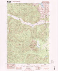
1983 Map of Goat Mountain
USGS Topo · Published 1984About this map
Mount St Helens National Volcanic Monument dominates the eastern boundary of this map, recorded just years after the 1980 eruption. The landscape shows the immediate geological aftermath, with labels like "Eruption Line" and numerous Borrow Pits and gravel extractions indicating the massive civil engineering and recovery efforts underway in the early 1980s. The South Fork Toutle River cuts through the center of the terrain, flanked by Disappointment Ridge and Spud Mtn. Within the Gifford Pinchot National Forest, high-elevation features like Goat Mtn and the tranquil Goat Marsh remain distinct. Hydrological patterns are well-documented, from the headwaters of the Kalama River to smaller alpine features like Blue Lake and McBride Lake, providing a clear record of the region's topography during a period of profound environmental change.
Find a feature on this map
22 named features on this map. Tap any name to fly to it.
Don’t see what you’re looking for? This feature index may not catch every label — zoom into the map to look around manually.
Map Details
Editions of this 1983 Goat Mountain Map
This is the sole edition of this map. No revisions or reprints were ever made.
Other maps of this area

1919 · Mount St Helens
USGS Topo · 1:125,000

1953 · Hoquiam
USGS Topo · 1:250,000

1953 · Cougar
USGS Topo · 1:62,500

1953 · Elk Rock
USGS Topo · 1:62,500

1957 · Hoquiam
USGS Topo · 1:250,000

1957 · Spirit Lake
USGS Topo · 1:62,500

1958 · Mt St. Helens
USGS Topo · 1:62,500

1958 · Hoquiam
USGS Topo · 1:250,000

1962 · Hoquiam
USGS Topo · 1:250,000

1975 · Spirit Lake SW
USGS Topo · 1:24,000