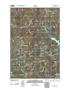
2011 Map of Gobblers Knob
USGS Topo · Published 2011About this map
Barney Reservoir sits as a central hydrological feature in this high-elevation region of Washington County, where the headwaters of several major Oregon river systems diverge. The map documents a complex network of timber and access roads, such as NW Flora Mainline and the NW Trask Toll Rd, which snake through the steep divides of Grindstone Ridge and Blind Cabin Ridge. This landscape is defined by its deep drainages, including the North Fork Trask River and the North Yamhill River, highlighting the area's role as a critical watershed. Local landmarks like Ki-a-Kuts Falls and the prominent Gobblers Knob provide specific points of reference within the dense topography. For researchers, the presence of Murphys Camp and various spur ridges like Simmons Spur suggests a history tied to forest management and backcountry navigation at the start of the 21st century.
Find a feature on this map
41 named features on this map. Tap any name to fly to it.
Don’t see what you’re looking for? This feature index may not catch every label — zoom into the map to look around manually.
Map Details
Editions of this 2011 Gobblers Knob Map
This is the sole edition of this map. No revisions or reprints were ever made.
Other maps of this area

1937 · Enright
USGS Topo · 1:62,500

1941 · Timber
USGS Topo · 1:62,500

1941 · Enright
USGS Topo · 1:62,500

1942 · Ginger Peak
USGS Topo · 1:62,500

1942 · Fairdale
USGS Topo · 1:62,500

1948 · Vancouver
USGS Topo · 1:250,000

1950 · Vancouver
USGS Topo · 1:250,000

1950 · Vancouver
USGS Topo · 1:250,000

1955 · Blaine
USGS Topo · 1:62,500

1955 · Timber
USGS Topo · 1:62,500