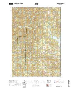
2020 Map of Gobblers Knob
USGS Topo · Published 2020About this map
Barney Reservoir sits at the eastern edge of this high-elevation landscape where the borders of Washington, Tillamook, and Yamhill counties converge. The terrain is defined by a dense network of timber access roads and dramatic topography, including the namesake Gobblers Knob and the prominent Grindstone Ridge. This 2020 survey reveals the modern industrial forest layout, characterized by named logging grades and mainline routes such as the NW Flora Mainline and Headquarters Grade.
Find a feature on this map
45 named features on this map. Tap any name to fly to it.
Don’t see what you’re looking for? This feature index may not catch every label — zoom into the map to look around manually.
Map Details
Editions of this 2020 Gobblers Knob Map
This is the sole edition of this map. No revisions or reprints were ever made.
Other maps of this area

1937 · Enright
USGS Topo · 1:62,500

1941 · Timber
USGS Topo · 1:62,500

1941 · Enright
USGS Topo · 1:62,500

1942 · Ginger Peak
USGS Topo · 1:62,500

1942 · Fairdale
USGS Topo · 1:62,500

1948 · Vancouver
USGS Topo · 1:250,000

1950 · Vancouver
USGS Topo · 1:250,000

1950 · Vancouver
USGS Topo · 1:250,000

1955 · Blaine
USGS Topo · 1:62,500

1955 · Timber
USGS Topo · 1:62,500