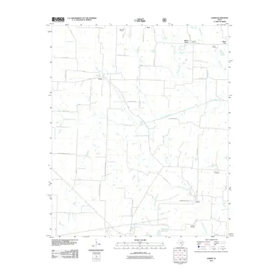
2010 Map of Gober
USGS Topo · Published 2010About this map
Gober serves as the central hub of this North Texas landscape, where several secondary roads and farm-to-market routes converge amidst a network of creek drainages. The area is defined by the three branches of the Sulphur River system, including the North Sulphur River and the Middle Sulphur River, which flow eastward across the quadrangle. For genealogists and local historians, the distribution of burial sites provides a clear record of early settlement patterns and family lineage, with well-documented locations such as Providence Cemetery, Biggerstaff Cemetery, and Woods Cemetery scattered near the small communities of Hail and Silver City. To the south, the Wolfe City Reservoirs are prominent landmarks near the headwaters of Short Creek. This map reveals a transition between established rural hamlets like Bartley Woods and the agricultural lands that define the county's interior.
Find a feature on this map
55 named features on this map. Tap any name to fly to it.
Don’t see what you’re looking for? This feature index may not catch every label — zoom into the map to look around manually.
Map Details
Editions of this 2010 Gober Map
This is the sole edition of this map. No revisions or reprints were ever made.
Other maps of this area

1903 · Paris
USGS Topo · 1:125,000

1947 · Honey Grove
USGS Topo · 1:62,500

1949 · Honey Grove
USGS Topo · 1:62,500

1953 · Texarkana
USGS Topo · 1:250,000

1954 · Sherman
USGS Topo · 1:250,000

1956 · Texarkana
USGS Topo · 1:250,000

1958 · Bonham
USGS Topo · 1:62,500

1958 · Sherman
USGS Topo · 1:250,000

1964 · Commerce North
USGS Topo · 1:24,000

1964 · Celeste
USGS Topo · 1:24,000