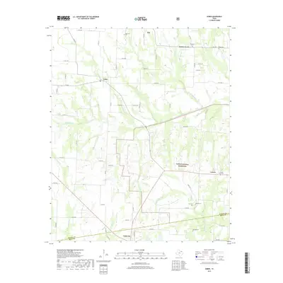
2019 Map of Gober
USGS Topo · Published 2019About this map
The North Sulphur River and its tributary N Sulphur River carve through the agricultural landscape of Fannin and Hunt Counties in this recent survey. To the south, Wolfe City serves as a local hub, while the settlements of Gober and Ladonia are positioned amidst a network of farm-to-market roads and rural cemeteries. The presence of the Caddo National Grassland highlights conservation efforts in the region, preserving the native prairie and woodland character. Genealogists will find a high density of family burial sites, including Biggerstaff Cem, Providence Cem, and Rehobeth Cem, many of which sit near the banks of local waterways like Bear Cr and Middle Sulphur River. The map illustrates a rural Texas landscape where modern road infrastructure follows the paths of historic land divisions.
Find a feature on this map
65 named features on this map. Tap any name to fly to it.
Don’t see what you’re looking for? This feature index may not catch every label — zoom into the map to look around manually.
Map Details
Editions of this 2019 Gober Map
This is the sole edition of this map. No revisions or reprints were ever made.
Other maps of this area

1903 · Paris
USGS Topo · 1:125,000

1947 · Honey Grove
USGS Topo · 1:62,500

1949 · Honey Grove
USGS Topo · 1:62,500

1953 · Texarkana
USGS Topo · 1:250,000

1954 · Sherman
USGS Topo · 1:250,000

1956 · Texarkana
USGS Topo · 1:250,000

1958 · Bonham
USGS Topo · 1:62,500

1958 · Sherman
USGS Topo · 1:250,000

1964 · Commerce North
USGS Topo · 1:24,000

1964 · Celeste
USGS Topo · 1:24,000