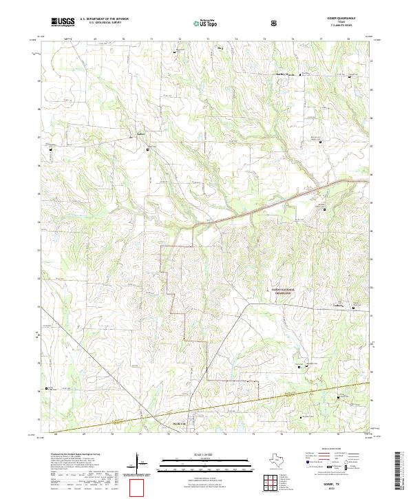
2022 Map of Gober
USGS Topo · Published 2022About this map
Caddo National Grassland dominates the central and southern portions of this North Texas terrain, illustrating a landscape of public conservation interspersed with small rural communities. The map details the transition between Fannin and Hunt counties, anchored by the settlements of Gober, Ladonia, and Wolfe City. A significant number of family and community burial sites are scattered across the quadrangle, including the Burrows and Harper Cem, Philadelphia Cem, and Henslee Family Cem, providing valuable landmarks for local genealogical research. Hydrological features define the local topography, with the North Sulphur River and the Middle Sulphur River winding through the grasslands and pasture. The road network, comprising various farm-to-market roads and county routes like FM 68 and FM 1743, connects these long-established agricultural outposts and rural church sites.
Find a feature on this map
73 named features on this map. Tap any name to fly to it.
Don’t see what you’re looking for? This feature index may not catch every label — zoom into the map to look around manually.
Map Details
Editions of this 2022 Gober Map
This is the sole edition of this map. No revisions or reprints were ever made.
Other maps of this area

1903 · Paris
USGS Topo · 1:125,000

1947 · Honey Grove
USGS Topo · 1:62,500

1949 · Honey Grove
USGS Topo · 1:62,500

1953 · Texarkana
USGS Topo · 1:250,000

1954 · Sherman
USGS Topo · 1:250,000

1956 · Texarkana
USGS Topo · 1:250,000

1958 · Bonham
USGS Topo · 1:62,500

1958 · Sherman
USGS Topo · 1:250,000

1964 · Commerce North
USGS Topo · 1:24,000

1964 · Celeste
USGS Topo · 1:24,000