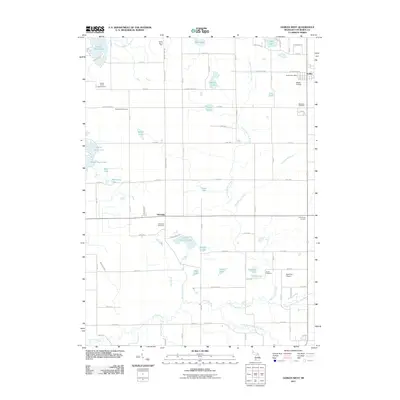
2011 Map of Gobles West
USGS Topo · Published 2011About this map
Glendale and the western outskirts of Gobles define this agricultural and lake-rich landscape in Van Buren County. The area is characterized by a dense concentration of water bodies, from the prominent Great Bear Lake in the northwest to School Section Lake and Round Lake further south. These lakes are connected by an intricate network of waterways, including Brandywine Creek and the North Extension Drain, which eventually feed into the North Branch Paw Paw River.
Find a feature on this map
84 named features on this map. Tap any name to fly to it.
Don’t see what you’re looking for? This feature index may not catch every label — zoom into the map to look around manually.
Map Details
Editions of this 2011 Gobles West Map
This is the sole edition of this map. No revisions or reprints were ever made.
Other maps of this area

1927 · Hartford
USGS Topo · 1:62,500

1927 · Bangor
USGS Topo · 1:62,500

1931 · Bangor
USGS Topo · 1:62,500

1931 · Hartford
USGS Topo · 1:62,500

1943 · Bangor
USGS Topo · 1:62,500

1944 · Marcellus
USGS Topo · 1:62,500

1946 · Marcellus
USGS Topo · 1:62,500

1946 · Gobles
USGS Topo · 1:62,500

1948 · Gobles
USGS Topo · 1:62,500

1949 · Gobles
USGS Topo · 1:62,500