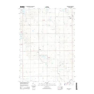
2014 Map of Gobles West
USGS Topo · Published 2014About this map
The town of Gobles and the settlement of Glendale anchor this landscape in Van Buren County, defined by a dense network of glacial lakes and drainage systems. The Paw Paw River flows through the southern portion of the quadrangle, fed by several tributaries including the S Br Paw Paw River and N Br Paw Paw River. The terrain is punctuated by numerous named water bodies such as Great Bear Lake, School Section Lake, and Martin Lake, reflecting the region's complex post-glacial hydrology. Local heritage is preserved in several burial grounds, including Robinson Cem, Evergreen Cem, and Austin Cem. The area's agricultural and rural character is reinforced by a grid of county roads and avenues, while drainage projects like the N Extension Drain and Rich-Dillon Drain illustrate the long-standing management of the low-lying wetlands between the hills.
Find a feature on this map
60 named features on this map. Tap any name to fly to it.
Don’t see what you’re looking for? This feature index may not catch every label — zoom into the map to look around manually.
Map Details
Editions of this 2014 Gobles West Map
This is the sole edition of this map. No revisions or reprints were ever made.
Other maps of this area

1927 · Hartford
USGS Topo · 1:62,500

1927 · Bangor
USGS Topo · 1:62,500

1931 · Bangor
USGS Topo · 1:62,500

1931 · Hartford
USGS Topo · 1:62,500

1943 · Bangor
USGS Topo · 1:62,500

1944 · Marcellus
USGS Topo · 1:62,500

1946 · Marcellus
USGS Topo · 1:62,500

1946 · Gobles
USGS Topo · 1:62,500

1948 · Gobles
USGS Topo · 1:62,500

1949 · Gobles
USGS Topo · 1:62,500