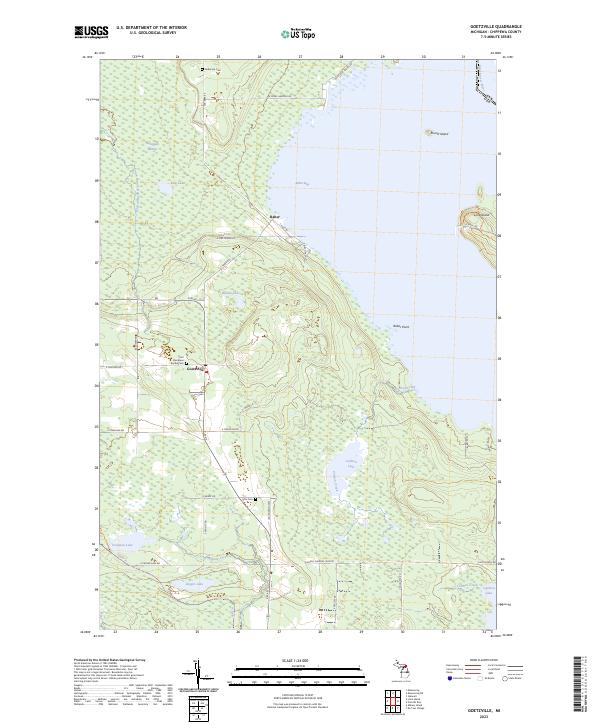
2023 Map of Goetzville
USGS Topo · Published 2023About this map
Goetzville and Raber serve as the primary hubs of this Upper Peninsula landscape, situated along the western edge of the Saint Marys River corridor. The geography is defined by a heavy presence of wetlands and interior water bodies, including the expansive Gogomain Swamp and Kirk Lake to the north, which contrast with the coastline of Raber Bay. The map provides significant detail for family historians, documenting burial grounds such as Saint Stanislaus Kostka Cem and Anderson Cem. To the east, the international boundary with Canada runs through the river channel, separating the mainland from prominent landforms like Lime Island and Round Island. The interior is marked by a network of drainage systems like Carlton Creek and Albany Creek, illustrating the natural water management of the Chippewa County terrain.
Find a feature on this map
48 named features on this map. Tap any name to fly to it.
Don’t see what you’re looking for? This feature index may not catch every label — zoom into the map to look around manually.
Map Details
Editions of this 2023 Goetzville Map
This is the sole edition of this map. No revisions or reprints were ever made.
Other maps of this area

1953 · Munuscong
USGS Topo · 1:24,000

1953 · Munuscong NE
USGS Topo · 1:24,000

1954 · Alpena
USGS Topo · 1:250,000

1954 · Sault Sainte Marie
USGS Topo · 1:250,000

1955 · Cheboygan
USGS Topo · 1:250,000

1956 · Sault Sainte Marie
USGS Topo · 1:250,000

1957 · Alpena
USGS Topo · 1:250,000

1957 · Sault Sainte Marie
USGS Topo · 1:250,000

1958 · Cheboygan
USGS Topo · 1:250,000

1958 · Alpena
USGS Topo · 1:250,000