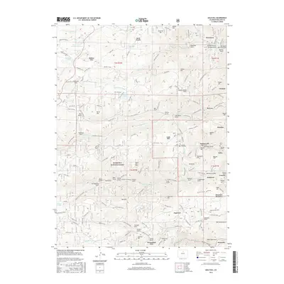
2016 Map of Gold Hill
USGS Topo · Published 2016About this map
Gold Hill stands as a central historical anchor in this portion of the Front Range, surrounded by a dense network of mining-era settlements and geographic features. The landscape is defined by its deep gulches and high peaks, where the transition from early prospecting to established communities is visible through the placement of the Gold Hill Cem and the Salina Cem. These burial grounds, alongside landmarks like Schoolhouse Gulch, speak to the generations of families who settled here. The map traces the winding paths of Lefthand Canyon Drive and Sunshine Canyon Dr, which connect the mountain hamlets of Jamestown, Summerville, and Salina. To the south, the historic Switzerland Trail winds through the terrain near Sugarloaf and Switzerland Park, following the path of the old narrow-gauge railroad that once served these mining districts. Heavily forested sections of the Roosevelt National Forest frame the area, which remains defined by its steep topography and cold-water drainages like Middle Boulder Cr.
Find a feature on this map
79 named features on this map. Tap any name to fly to it.
Don’t see what you’re looking for? This feature index may not catch every label — zoom into the map to look around manually.
Map Details
Editions of this 2016 Gold Hill Map
This is the sole edition of this map. No revisions or reprints were ever made.
Other maps of this area

1899 · West Denver
USGS Topo · 1:125,000

1902 · Boulder
USGS Topo · 1:62,500

1904 · Boulder
USGS Topo · 1:62,500

1905 · Central City
USGS Topo · 1:62,500

1906 · Blackhawk
USGS Topo · 1:62,500

1910 · Central City
USGS Topo · 1:62,500

1912 · Central City
USGS Topo · 1:62,500

1915 · Longs Peak
USGS Topo · 1:125,000

1919 · Rocky Mountain National Park
USGS Topo · 1:125,000

1942 · Eldorado Springs
USGS Topo · 1:24,000