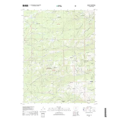
2019 Map of Gold Hill
USGS Topo · Published 2019About this map
Jamestown and Gold Hill anchor this portion of the Front Range, where steep gulches and high ridges dictated the layout of early mining roads and settlements. The landscape is defined by its deep history of extraction, visible through features like Nancy Mine Rd and the Caille Cabin. Smaller settlements such as Summerville, Salina, and Wallstreet line the narrow corridors of Fourmile Creek and its tributaries, while Rowena and Bark Ranch occupy the northern reaches of the quadrangle. High-altitude burial grounds, including the Gold Hill Cem and Salina Cem, serve as important markers for genealogists researching families from the local mining camps. The network of historical paths like the Switzerland Trail and the complex drainage system of Left Hand Creek reveal the physical challenges of navigating this gold-bearing terrain during its industrial peak and subsequent residential evolution.
Find a feature on this map
133 named features on this map. Tap any name to fly to it.
Don’t see what you’re looking for? This feature index may not catch every label — zoom into the map to look around manually.
Map Details
Editions of this 2019 Gold Hill Map
This is the sole edition of this map. No revisions or reprints were ever made.
Other maps of this area

1899 · West Denver
USGS Topo · 1:125,000

1902 · Boulder
USGS Topo · 1:62,500

1904 · Boulder
USGS Topo · 1:62,500

1905 · Central City
USGS Topo · 1:62,500

1906 · Blackhawk
USGS Topo · 1:62,500

1910 · Central City
USGS Topo · 1:62,500

1912 · Central City
USGS Topo · 1:62,500

1915 · Longs Peak
USGS Topo · 1:125,000

1919 · Rocky Mountain National Park
USGS Topo · 1:125,000

1942 · Eldorado Springs
USGS Topo · 1:24,000