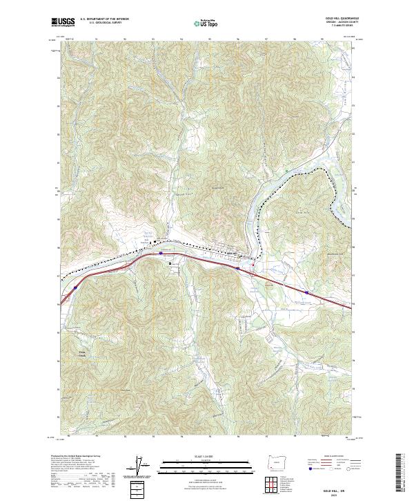
2023 Map of Gold Hill
USGS Topo · Published 2023About this map
The Rogue River carves a central path through this Southern Oregon landscape, where the town of Gold Hill serves as a hub of activity. This contemporary survey reveals a complex network of water management features, including the Gold Hill Irrigation District Canal and several significant water bodies like Del Rio Reservoir and Estramado Reservoir. The river's natural power is evident at Ti'lomikh Falls and Dillon Falls, while numerous riffles like Hardy Riffle mark its course. For those researching local families, the map precisely locates several burial grounds including Gold Hill IOOF Cem, Rock Point Cem, and Hays Cem. The surrounding terrain is defined by prominent elevations such as Nugget Butte and Blackwell Hill, while agricultural and residential development stretches into Sams Valley to the northeast.
Find a feature on this map
93 named features on this map. Tap any name to fly to it.
Don’t see what you’re looking for? This feature index may not catch every label — zoom into the map to look around manually.
Map Details
Editions of this 2023 Gold Hill Map
This is the sole edition of this map. No revisions or reprints were ever made.
Other maps of this area

1891 · Ashland
USGS Topo · 1:250,000

1893 · Ashland
USGS Topo · 1:250,000

1897 · Ashland
USGS Topo · 1:250,000

1904 · Riddle
USGS Topo · 1:125,000

1908 · Grants Pass
USGS Topo · 1:125,000

1938 · Medford
USGS Topo · 1:125,000

1943 · Trail
USGS Topo · 1:62,500

1954 · Medford
USGS Topo · 1:62,500

1954 · Gold Hill
USGS Topo · 1:62,500

1954 · Wimer
USGS Topo · 1:62,500