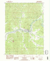
1983 Map of Gold Hill
USGS Topo · Published 1983About this map
The Rogue River carves through the landscape of Jackson County, serving as the central artery for the town of Gold Hill and the neighboring Rock Point. This 1983 provisional edition documents a region deeply shaped by its mineral history and water-powered infrastructure. A series of mining operations are scattered across the hills, including the Sylvanite Mine, the Gold Hill Mine (Open Pit), and the Bill Nye Mine south of Bill Nye Creek. The map shows the industrial footprint of the Southern Pacific railroad and Interstate 5 as they navigate the river valley, alongside the Concrete Diversion Dam and Power House that manage the river's flow.
Find a feature on this map
44 named features on this map. Tap any name to fly to it.
Don’t see what you’re looking for? This feature index may not catch every label — zoom into the map to look around manually.
Map Details
Editions of this 1983 Gold Hill Map
This is the sole edition of this map. No revisions or reprints were ever made.
Other maps of this area

1891 · Ashland
USGS Topo · 1:250,000

1893 · Ashland
USGS Topo · 1:250,000

1897 · Ashland
USGS Topo · 1:250,000

1904 · Riddle
USGS Topo · 1:125,000

1908 · Grants Pass
USGS Topo · 1:125,000

1938 · Medford
USGS Topo · 1:125,000

1943 · Trail
USGS Topo · 1:62,500

1954 · Medford
USGS Topo · 1:62,500

1954 · Gold Hill
USGS Topo · 1:62,500

1954 · Wimer
USGS Topo · 1:62,500