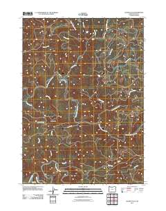
2011 Map of Golden Falls
USGS Topo · Published 2011About this map
Golden and Silver Falls St Park anchors this portion of Coos County, preserving a landscape defined by the drainage basins of the East Fork Millicoma River and the South Fork Coos River. The terrain is characterized by a dense network of watercourses, including Matson Creek, Silver Creek, and Glenn Creek, which tumble over landmarks such as Golden Falls, Silver Falls, and Hewett Falls. This 2011 survey reflects the region's long-standing connection to the timber industry, evidenced by Weyerhaeuser Ln winding through the hills near Taylor Butte. The presence of the Coos River Fish Hatchery near the confluence of major forks underscores the ongoing management of the area's aquatic resources. Significant elevation points like Vaughn Point overlook the numerous tributaries, including Rodine Creek and Marlow Creek, that feed the larger river systems of the Oregon coast range.
Find a feature on this map
29 named features on this map. Tap any name to fly to it.
Don’t see what you’re looking for? This feature index may not catch every label — zoom into the map to look around manually.
Map Details
Editions of this 2011 Golden Falls Map
This is the sole edition of this map. No revisions or reprints were ever made.
Other maps of this area

1896 · Coos Bay
USGS Topo · 1:125,000

1898 · Coos Bay
USGS Topo · 1:125,000

1900 · Coos Bay
USGS Topo · 1:125,000

1923 · Reedsport
USGS Topo · 1:62,500

1928 · Sitkum
USGS Topo · 1:125,000

1942 · Reedsport
USGS Topo · 1:62,500

1942 · Coos Bay
USGS Topo · 1:62,500

1945 · Coos Bay
USGS Topo · 1:62,500

1954 · Coos Bay
USGS Topo · 1:250,000

1955 · Scottsburg
USGS Topo · 1:62,500