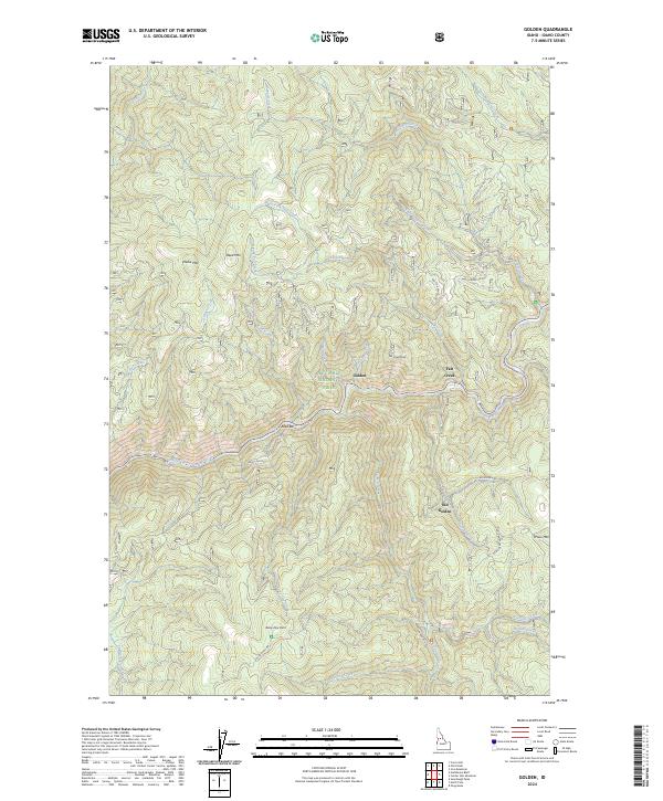
2024 Map of Golden
USGS Topo · Published 2024About this map
The Nez Perce National Forest surrounds the mining-era settlements of Golden and Old Golden along the steep valley of the South Fork Clearwater River. This 2024 survey captures the remote character of central Idaho, where the landscape is defined by the drainage systems of Leggett Creek, Tenmile Creek, and Fall Creek. The geography here reflects a history of placer mining and timber access, with named points like Reed Bar and Rainy Day Point dotting the riverside and ridge lines. Prominent peaks including Reed Mtn and Nellie Mtn rise above the river canyon, which is navigated by modern forest development roads and historical routes like Old Golden Rd and Sourdough Rd. The map illustrates the shift from early settlement at Old Golden to the later concentration of activity further downriver at Golden.
Find a feature on this map
40 named features on this map. Tap any name to fly to it.
Don’t see what you’re looking for? This feature index may not catch every label — zoom into the map to look around manually.
Map Details
Editions of this 2024 Golden Map
This is the sole edition of this map. No revisions or reprints were ever made.
Other maps of this area

1931 · Buffalo Hump
USGS Topo · 1:125,000

1934 · Buffalo Hump
USGS Topo · 1:125,000

1956 · Elk City
USGS Topo · 1:250,000

1960 · Elk City
USGS Topo · 1:250,000

1962 · Golden
USGS Topo · 1:24,000

1962 · Center Star Mtn
USGS Topo · 1:24,000

1962 · Iron Mtn
USGS Topo · 1:24,000

1962 · Pilot Knob
USGS Topo · 1:24,000

1963 · Sourdough Peak
USGS Topo · 1:24,000

1963 · Huddleson Bluff
USGS Topo · 1:24,000