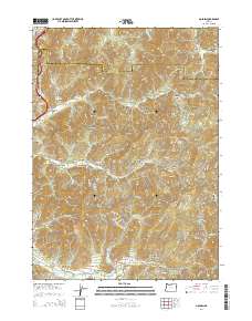
2014 Map of Golden
USGS Topo · Published 2014About this map
The settlement of Golden lies at the heart of this landscape, positioned where Coyote Cr meets the intersection of numerous gulches and canyons. To the south, the community of Placer sits along the banks of Grave Cr, anchored by the Placer Cem and the nearby Quartz Mill Gulch. This area is defined by a complex network of Bureau of Land Management (BLM) roads that navigate the high peaks of Saint Paul Mtn and Saint Peter Mtn.
Find a feature on this map
102 named features on this map. Tap any name to fly to it.
Don’t see what you’re looking for? This feature index may not catch every label — zoom into the map to look around manually.
Map Details
Editions of this 2014 Golden Map
This is the sole edition of this map. No revisions or reprints were ever made.
Other maps of this area
1904 · Riddle
USGS Topo · 1:125,000
1954 · Days Creek
USGS Topo · 1:62,500
1954 · Glendale
USGS Topo · 1:62,500
1954 · Wimer
USGS Topo · 1:62,500
1954 · Canyonville
USGS Topo · 1:62,500

1955 · Medford
USGS Topo · 1:250,000
1957 · Medford
USGS Topo · 1:250,000
1958 · Medford
USGS Topo · 1:250,000
1983 · Wimer
USGS Topo · 1:24,000
1983 · King Mountain
USGS Topo · 1:24,000