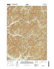
2017 Map of Golden
USGS Topo · Published 2017About this map
Golden and Placer serve as the primary historic nodes in this southwestern Oregon landscape, where the topography is defined by an intricate network of drainage ravines. The area's legacy is etched into names like Panning Gulch, Quartz Mill Gulch, and Schoolhouse Gulch, reflecting a history of resource extraction and local community building along Grave Cr and Coyote Cr. Small settlements such as Buckhorn and Speaker are situated north of the main drainages, while the Placer Cem remains a quiet landmark of the early inhabitants. Transportation through the Josephine and Douglas county lines is marked by the Stage Road Pass, following the natural contours of Stage Road Gulch. Water management is evident through the presence of the Strong Reservoir and Secesh Reservoir, essential for the region's development. This survey provides a comprehensive look at the land's transition from early mining camps to the enduring rural character found today.
Find a feature on this map
76 named features on this map. Tap any name to fly to it.
Don’t see what you’re looking for? This feature index may not catch every label — zoom into the map to look around manually.
Map Details
Editions of this 2017 Golden Map
This is the sole edition of this map. No revisions or reprints were ever made.
Other maps of this area
1904 · Riddle
USGS Topo · 1:125,000
1954 · Days Creek
USGS Topo · 1:62,500
1954 · Glendale
USGS Topo · 1:62,500
1954 · Wimer
USGS Topo · 1:62,500
1954 · Canyonville
USGS Topo · 1:62,500

1955 · Medford
USGS Topo · 1:250,000
1957 · Medford
USGS Topo · 1:250,000
1958 · Medford
USGS Topo · 1:250,000
1983 · Wimer
USGS Topo · 1:24,000
1983 · King Mountain
USGS Topo · 1:24,000