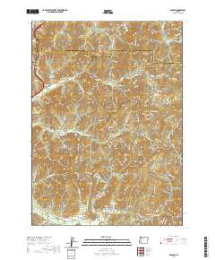
2020 Map of Golden
USGS Topo · Published 2020About this map
The settlement of Golden lies at the heart of this landscape, surrounded by a complex network of drainages that speak to the area's mining heritage. Labels like Panning Gulch, Quartz Mill Gulch, and Sourdough Gulch underscore the extraction history along the tributaries of Grave Cr and Wolf Cr. To the south, the community of Placer is noted alongside the Placer Cem, providing a focal point for genealogical research in this part of Josephine County.
Find a feature on this map
125 named features on this map. Tap any name to fly to it.
Don’t see what you’re looking for? This feature index may not catch every label — zoom into the map to look around manually.
Map Details
Editions of this 2020 Golden Map
This is the sole edition of this map. No revisions or reprints were ever made.
Other maps of this area

1904 · Riddle
USGS Topo · 1:125,000

1954 · Days Creek
USGS Topo · 1:62,500

1954 · Glendale
USGS Topo · 1:62,500

1954 · Wimer
USGS Topo · 1:62,500

1954 · Canyonville
USGS Topo · 1:62,500

1955 · Medford
USGS Topo · 1:250,000

1957 · Medford
USGS Topo · 1:250,000

1958 · Medford
USGS Topo · 1:250,000
1983 · Wimer
USGS Topo · 1:24,000
1983 · King Mountain
USGS Topo · 1:24,000