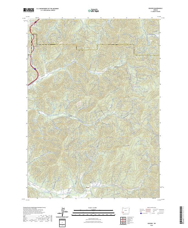
2024 Map of Golden
USGS Topo · Published 2024About this map
Golden and Placer occupy the lower reaches of this Josephine County landscape, where the naming conventions of the terrain reflect a history of mineral exploration. From Panning Gulch to Quartz Mill Gulch and Greenback Mine Rd, the map records the enduring footprint of the region's mining heritage. The area is defined by a dense network of gulches and creeks, including Coyote Creek and Grave Creek, which channel through the high elevations of Saint Peter Mtn and Saint Paul Mtn. To the north, the settlement of Speaker and the crossing at Stage Road Pass indicate established transit corridors connecting these mountain communities. Water management is evident through the presence of Strong Reservoir and Secesh Reservoir, while the Placer Cem serves as a quiet marker of the families who settled this territory along the Douglas County line.
Find a feature on this map
101 named features on this map. Tap any name to fly to it.
Don’t see what you’re looking for? This feature index may not catch every label — zoom into the map to look around manually.
Map Details
Editions of this 2024 Golden Map
This is the sole edition of this map. No revisions or reprints were ever made.
Other maps of this area

1904 · Riddle
USGS Topo · 1:125,000

1954 · Days Creek
USGS Topo · 1:62,500

1954 · Glendale
USGS Topo · 1:62,500

1954 · Wimer
USGS Topo · 1:62,500

1954 · Canyonville
USGS Topo · 1:62,500

1955 · Medford
USGS Topo · 1:250,000

1957 · Medford
USGS Topo · 1:250,000

1958 · Medford
USGS Topo · 1:250,000
1983 · Wimer
USGS Topo · 1:24,000
1983 · King Mountain
USGS Topo · 1:24,000