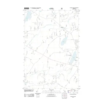
2011 Map of Golden Lake
USGS Topo · Published 2011About this map
The University of Michigan Forestry Camp stands as a focal point for academic research and field study in this corner of the Upper Peninsula, located on the western shore of Golden Lake. The landscape is defined by the hydrologic network of the South Branch Paint River and Cooks Run, which navigate a complex of wetlands and secondary forest roads. The small settlement of Elmwood is situated at a bridge crossing in the northern portion of the map, serving as a rare point of habitation in a region otherwise dominated by public land management. Forestry and conservation history are evident through features like the Golden Lake Lookout Tower and the Golden Lake Recreation Area. The road network, including Tamarack Lake Rd and various federal forest routes, indicates a landscape primarily utilized for timber management and seasonal recreation rather than intensive residential development.
Find a feature on this map
20 named features on this map. Tap any name to fly to it.
Don’t see what you’re looking for? This feature index may not catch every label — zoom into the map to look around manually.
Map Details
Editions of this 2011 Golden Lake Map
This is the sole edition of this map. No revisions or reprints were ever made.
Other maps of this area

1938 · Phelps
USGS Topo · 1:48,000

1950 · Phelps
USGS Topo · 1:48,000

1952 · Watersmeet
USGS Topo · 1:62,500

1954 · Kenton
USGS Topo · 1:62,500

1956 · Beechwood
USGS Topo · 1:62,500

1956 · Phelps
USGS Topo · 1:62,500

1958 · Iron River
USGS Topo · 1:250,000

1960 · Iron River
USGS Topo · 1:250,000

1961 · Iron River
USGS Topo · 1:250,000

1967 · Iron River
USGS Topo · 1:250,000