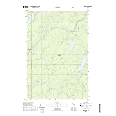
2019 Map of Golden Lake
USGS Topo · Published 2019About this map
Ottawa National Forest dominates this section of the Upper Peninsula, where the Paint Wild and Scenic River and its tributaries define the landscape. Near the settlement of Elmwood, the river system branches into the Canoe South Branch Paint River (Water), highlighting the region's importance for waterborne travel and recreation. The map details a high density of glacial lakes, from the large James Lake and Golden Lake in the east to Tamarack Lake and Elk Lake along the Gogebic and Iron county line.
Find a feature on this map
25 named features on this map. Tap any name to fly to it.
Don’t see what you’re looking for? This feature index may not catch every label — zoom into the map to look around manually.
Map Details
Editions of this 2019 Golden Lake Map
This is the sole edition of this map. No revisions or reprints were ever made.
Other maps of this area

1938 · Phelps
USGS Topo · 1:48,000

1950 · Phelps
USGS Topo · 1:48,000

1952 · Watersmeet
USGS Topo · 1:62,500

1954 · Kenton
USGS Topo · 1:62,500

1956 · Beechwood
USGS Topo · 1:62,500

1956 · Phelps
USGS Topo · 1:62,500

1958 · Iron River
USGS Topo · 1:250,000

1960 · Iron River
USGS Topo · 1:250,000

1961 · Iron River
USGS Topo · 1:250,000

1967 · Iron River
USGS Topo · 1:250,000