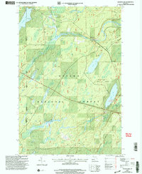
1999 Map of Golden Lake
USGS Topo · Published 2004About this map
Ottawa National Forest dominates this section of the Upper Peninsula, where the landscape is defined by a dense network of glacial lakes and waterways at the border of Gogebic and Iron counties. The small settlement of Elmwood sits along the Paint River, serving as a focal point for navigation through the forest. The drainage patterns of Thirtythree Creek and Cooks Run emphasize the area's importance for timber and water resources, with recreation becoming more prominent by the late 20th century at sites like the Golden Lake Recreation Area.
Find a feature on this map
21 named features on this map. Tap any name to fly to it.
Don’t see what you’re looking for? This feature index may not catch every label — zoom into the map to look around manually.
Map Details
Editions of this 1999 Golden Lake Map
This is the sole edition of this map. No revisions or reprints were ever made.
Other maps of this area

1938 · Phelps
USGS Topo · 1:48,000

1950 · Phelps
USGS Topo · 1:48,000

1952 · Watersmeet
USGS Topo · 1:62,500

1954 · Kenton
USGS Topo · 1:62,500

1956 · Beechwood
USGS Topo · 1:62,500

1956 · Phelps
USGS Topo · 1:62,500

1958 · Iron River
USGS Topo · 1:250,000

1960 · Iron River
USGS Topo · 1:250,000

1961 · Iron River
USGS Topo · 1:250,000

1967 · Iron River
USGS Topo · 1:250,000