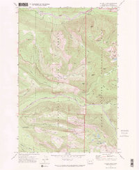
1971 Map of Golden Lakes
USGS Topo · Published 1974About this map
Mount Rainier National Park and the Snoqualmie National Forest dominate this 1971 topographical survey, revealing the infrastructure of high-elevation conservation and recreation in Pierce County. The map documents the northern access points to the park, including the Carbon River Entrance and the Carbon River Ranger Station. This era shows a landscape managed for wilderness experience, evidenced by the winding path of the Wonderland Trail as it traverses the North Mowich River and climbs toward the cluster of Golden Lakes.
Find a feature on this map
43 named features on this map. Tap any name to fly to it.
Don’t see what you’re looking for? This feature index may not catch every label — zoom into the map to look around manually.
Map Details
Editions of this 1971 Golden Lakes Map
2 editions found
Other maps of this area

1897 · Tacoma
USGS Topo · 1:125,000

1900 · Tacoma
USGS Topo · 1:125,000

1913 · Cedar Lake
USGS Topo · 1:125,000

1924 · Mt Rainier
USGS Topo · 1:96,000

1928 · Mt Rainier
USGS Topo · 1:125,000

1937 · Eatonville
USGS Topo · 1:125,000

1942 · Lake Tapps
USGS Topo · 1:62,500

1944 · Lake Tapps
USGS Topo · 1:62,500

1950 · Yakima
USGS Topo · 1:250,000

1953 · Hoquiam
USGS Topo · 1:250,000