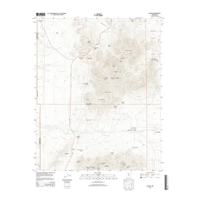
2013 Map of Golden
USGS Topo · Published 2013About this map
Golden sits at the southwestern base of the San Pedro Mountains, serving as a central point of settlement in this high-altitude landscape. The town is marked by the Golden Cemetery and is connected to the surrounding ranching and mining history through features like Dolores Ranch and Boxcar Camp. The geography is defined by a series of steep, naming-rich canyons and gulches, including Stagecoach Canyon, Gypsy Queen Canyon, and Cunningham Gulch, which drain the northern Ortiz Mountains. Large-scale land use is evident through the Lone Mountain Cattle Company near San Pedro Pass. Roadways like Gold Mine Rd and Corazon de Oro underscore the region's mineral heritage, while the complex system of arroyos, such as Arroyo Largo and Arroyo Tuerto, illustrates the critical role of seasonal water drainage in this part of Santa Fe and Sandoval Counties.
Find a feature on this map
49 named features on this map. Tap any name to fly to it.
Don’t see what you’re looking for? This feature index may not catch every label — zoom into the map to look around manually.
Map Details
Editions of this 2013 Golden Map
This is the sole edition of this map. No revisions or reprints were ever made.
Other maps of this area

1892 · San Pedro
USGS Topo · 1:125,000

1954 · Sandia Park
USGS Topo · 1:24,000

1954 · San Pedro
USGS Topo · 1:24,000

1954 · San Felipe Pueblo NE
USGS Topo · 1:24,000

1954 · Hagan
USGS Topo · 1:24,000

1954 · San Felipe Pueblo
USGS Topo · 1:62,500

1956 · Edgewood
USGS Topo · 1:62,500

1958 · Albuquerque
USGS Topo · 1:250,000

1961 · Madrid
USGS Topo · 1:62,500

1962 · Albuquerque
USGS Topo · 1:250,000