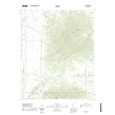
2023 Map of Golden
USGS Topo · Published 2023About this map
Golden serves as the primary focal point of this Santa Fe County landscape, situated along the Turquoise Trl where the high desert terrain meets the foothills of the Ortiz Mountains. The map reveals a high concentration of ephemeral watercourses and deep canyons, such as Arroyo Val Verde and Gypsy Queen Canyon, that define the area's hydrology and land use. Local history is anchored by the San Francisco Catholic Church Cem and the adjacent San Francisco Catholic Cem, marking the long-standing community presence in this mining-rich district. The topography is dominated by prominent peaks including Placer Mtn and San Pedro Mountain, separated by strategic gaps like San Pedro Pass. Named features like San Lazarus Gulch and Cunningham Hill suggest the area's legacy of prospecting and resource extraction that shaped this part of New Mexico.
Find a feature on this map
55 named features on this map. Tap any name to fly to it.
Don’t see what you’re looking for? This feature index may not catch every label — zoom into the map to look around manually.
Map Details
Editions of this 2023 Golden Map
This is the sole edition of this map. No revisions or reprints were ever made.
Other maps of this area

1892 · San Pedro
USGS Topo · 1:125,000

1954 · Sandia Park
USGS Topo · 1:24,000

1954 · San Pedro
USGS Topo · 1:24,000

1954 · San Felipe Pueblo NE
USGS Topo · 1:24,000

1954 · Hagan
USGS Topo · 1:24,000

1954 · San Felipe Pueblo
USGS Topo · 1:62,500

1956 · Edgewood
USGS Topo · 1:62,500

1958 · Albuquerque
USGS Topo · 1:250,000

1961 · Madrid
USGS Topo · 1:62,500

1962 · Albuquerque
USGS Topo · 1:250,000