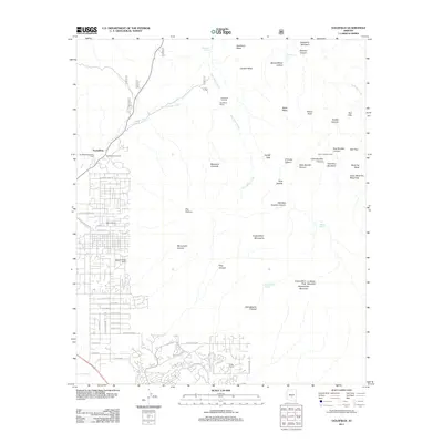
2011 Map of Goldfield
USGS Topo · Published 2011About this map
Goldfield Ghost Town and the neighboring settlement of Youngberg stand at the western edge of this desert landscape, where mining history meets modern expansion. The map details a complex transition from suburban residential grids like those along E Southern Ave and E Cloudview Ave to the dramatic verticality of the Superstition Mountains. Notable landmarks of the area's ranching and prospecting heritage are scattered throughout the terrain, including Kings Ranch, Saguaro Slope Ranch, and the Goldfield Mine Water Tower.
Find a feature on this map
76 named features on this map. Tap any name to fly to it.
Don’t see what you’re looking for? This feature index may not catch every label — zoom into the map to look around manually.
Map Details
Editions of this 2011 Goldfield Map
This is the sole edition of this map. No revisions or reprints were ever made.
Other maps of this area

1900 · Florence
USGS Topo · 1:125,000

1902 · Florence
USGS Topo · 1:125,000

1904 · Desert Well
USGS Topo · 1:62,500

1904 · Ft. McDowell
USGS Topo · 1:62,500

1906 · Ft. McDowell
USGS Topo · 1:62,500

1906 · Desert Well
USGS Topo · 1:62,500

1907 · Roosevelt
USGS Topo · 1:125,000

1909 · Four Peaks
USGS Topo · 1:125,000

1912 · Roosevelt
USGS Topo · 1:125,000

1930 · Cave Creek
USGS Topo · 1:125,000