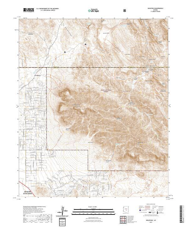
2021 Map of Goldfield
USGS Topo · Published 2021About this map
Youngberg and the western reaches of the Tonto National Forest dominate this landscape, where the residential grids of Apache Junction meet the steep volcanic geology of the Superstition Mountains. The map details the intricate drainage system of the area, including Siphon Draw leading up to The Flatiron and Hieroglyphic Canyon to the south. To the north, the Goldfield Mountains and the winding course of Weekes Wash provide a stark contrast to the developing street network of E McKellips Blvd and E Superstition Blvd.
Find a feature on this map
108 named features on this map. Tap any name to fly to it.
Don’t see what you’re looking for? This feature index may not catch every label — zoom into the map to look around manually.
Map Details
Editions of this 2021 Goldfield Map
This is the sole edition of this map. No revisions or reprints were ever made.
Other maps of this area

1900 · Florence
USGS Topo · 1:125,000

1902 · Florence
USGS Topo · 1:125,000

1904 · Desert Well
USGS Topo · 1:62,500

1904 · Ft. McDowell
USGS Topo · 1:62,500

1906 · Ft. McDowell
USGS Topo · 1:62,500

1906 · Desert Well
USGS Topo · 1:62,500

1907 · Roosevelt
USGS Topo · 1:125,000

1909 · Four Peaks
USGS Topo · 1:125,000

1912 · Roosevelt
USGS Topo · 1:125,000

1930 · Cave Creek
USGS Topo · 1:125,000