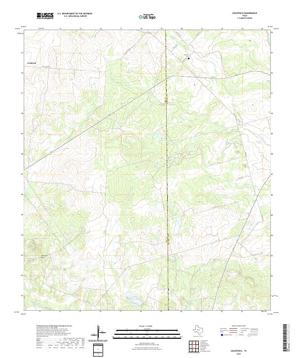
2022 Map of Goldfinch
USGS Topo · Published 2022About this map
The Frio Co Atascosa Co border bisects this South Texas landscape, where the small community of Goldfinch marks the western edge of the quadrangle. The terrain is defined by a network of ephemeral waterways and ranching infrastructure, such as the County Line Tank, which supports the agricultural operations common to this brush country. Near the northern boundary, the Chiltipin Cem serves as a significant landmark for genealogists and local historians, situated between the winding Chiltipin Cr and W Clear Cr. To the southwest, the Marshall Hills rise above the drainage of San Miguel Cr, while Miracle Lake provides a notable water feature in an otherwise arid expanse. The road network, including Davis Switch Rd and FM 140, illustrates the rural connectivity between scattered homesteads and local market centers in the early 21st century.
Find a feature on this map
28 named features on this map. Tap any name to fly to it.
Don’t see what you’re looking for? This feature index may not catch every label — zoom into the map to look around manually.
Map Details
Editions of this 2022 Goldfinch Map
This is the sole edition of this map. No revisions or reprints were ever made.
Other maps of this area

1934 · Schattel
USGS Topo · 1:62,500

1953 · Crystal City
USGS Topo · 1:250,000

1955 · Crystal City
USGS Topo · 1:250,000

1956 · Jourdanton
USGS Topo · 1:62,500

1956 · Hindes
USGS Topo · 1:62,500

1956 · Franklin Settlement
USGS Topo · 1:62,500

1961 · Crystal City
USGS Topo · 1:250,000

1968 · Crystal City
USGS Topo · 1:250,000
1968 · Dobrowolski
USGS Topo · 1:24,000
1968 · Schattel
USGS Topo · 1:24,000