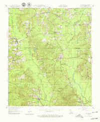
1957 Map of Goldonna
USGS Topo · Published 1979About this map
Saline Bayou and the Dugdemona River define this corner of North Louisiana, where the borders of Bienville, Winn, Jackson, and Natchitoches Parishes converge. Based on surveys from the mid-1940s and aerial revisions from 1956, the map documents the rural life of small timber and farming communities like Goldonna, Saline, and Friendship. The landscape is a network of bayous and creeks, including Baptistine Bayou and Mill Creek, interspersed with centers of faith and education like Carolina Ch and Shady Grove Sch.
Find a feature on this map
47 named features on this map. Tap any name to fly to it.
Don’t see what you’re looking for? This feature index may not catch every label — zoom into the map to look around manually.
Map Details
Editions of this 1957 Goldonna Map
3 editions found

Other maps of this area

1937 · Campti NE
USGS Topo · 1:31,680

1944 · Campti
USGS Topo · 1:62,500

1947 · Goldonna
USGS Topo · 1:62,500

1947 · Ashland
USGS Topo · 1:62,500

1947 · Bienville
USGS Topo · 1:62,500

1948 · Campti
USGS Topo · 1:62,500

1948 · Jamestown
USGS Topo · 1:62,500

1949 · Jamestown
USGS Topo · 1:62,500

1949 · Calvin NE
USGS Topo · 1:31,680

1949 · Bienville
USGS Topo · 1:62,500