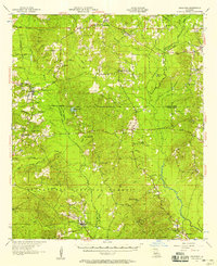
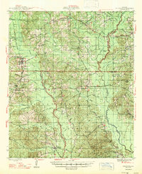
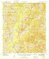
1957 Map of Goldonna
USGS Topo · Published 1957About this map
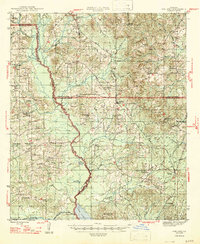
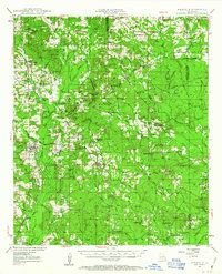
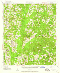
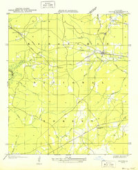
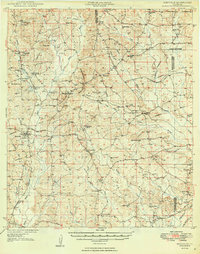
Goldonna and the surrounding pine-timbered parishes of Natchitoches, Bienville, and Winn are detailed in this mid-century survey. The landscape is defined by the winding Dugdemona River and a dense network of bayous and creeks, including Saline Bayou and Muddy Bayou. The Kansas City Southern Railroad cuts through the southwest, serving local timber and agricultural interests. Significant portions of the southern terrain are preserved within the Kisatchie National Forest, while the rest of the land is dotted with rural centers like Saline and Friendship.
Find a feature on this map
57 named features on this map. Tap any name to fly to it.
Don’t see what you’re looking for? This feature index may not catch every label — zoom into the map to look around manually.
Map Details
Editions of this 1957 Goldonna Map
3 editions found
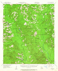
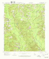
Other maps of this area

1937 · Campti NE
USGS Topo · 1:31,680
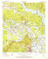
1944 · Campti
USGS Topo · 1:62,500
1947 · Goldonna
USGS Topo · 1:62,500
1947 · Ashland
USGS Topo · 1:62,500
1947 · Bienville
USGS Topo · 1:62,500

1948 · Campti
USGS Topo · 1:62,500
1948 · Jamestown
USGS Topo · 1:62,500
1949 · Jamestown
USGS Topo · 1:62,500
1949 · Calvin NE
USGS Topo · 1:31,680
1949 · Bienville
USGS Topo · 1:62,500