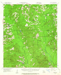
1957 Map of Goldonna
USGS Topo · Published 1963About this map
The Dugdemona River winds through this central Louisiana landscape, marking a terrain defined by deep pine woods and a network of parish boundaries including Bienville Parish, Winn Parish, and Natchitoches Parish. The settlement of Goldonna sits at the junction of the Southern Pacific railroad and an Old Railroad Grade, illustrating the region's historical reliance on timber and rail transport. The map reveals a high density of rural institutions that served these logging and farming communities, from the Shady Grove Sch to numerous churches like Carolina Ch, Morning Star Ch, and Mill Creek Ch.
Find a feature on this map
61 named features on this map. Tap any name to fly to it.
Don’t see what you’re looking for? This feature index may not catch every label — zoom into the map to look around manually.
Map Details
Editions of this 1957 Goldonna Map
3 editions found

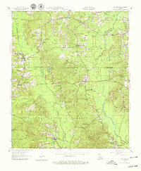
Other maps of this area

1937 · Campti NE
USGS Topo · 1:31,680

1944 · Campti
USGS Topo · 1:62,500

1947 · Goldonna
USGS Topo · 1:62,500

1947 · Ashland
USGS Topo · 1:62,500

1947 · Bienville
USGS Topo · 1:62,500

1948 · Campti
USGS Topo · 1:62,500

1948 · Jamestown
USGS Topo · 1:62,500

1949 · Jamestown
USGS Topo · 1:62,500

1949 · Calvin NE
USGS Topo · 1:31,680

1949 · Bienville
USGS Topo · 1:62,500