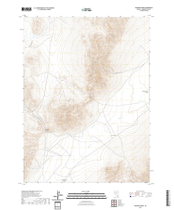
2021 Map of Goldrun Creek
USGS Topo · Published 2021About this map
Edna Mtn dominates the center of this terrain-focused Nevada landscape, anchoring a high-desert environment where water sources and access routes reflect the region's ranching and mineral exploration history. The drainage network is defined by Goldrun Cr and Ragan Cr, which flow through the expansive Pumpernickel Valley in the eastern portion of the map. To the west, Bill Majors Canyon cuts into the high ground, while Rock Cr flows across the northwest corner near Rock Creek Ranch Rd. The inclusion of Claims Rd near the mountain's southern slopes points to the area's ongoing importance for mining interests, while the intersection of Pumpernickel Valley Rd indicates the primary corridors used to navigate this corner of Humboldt County.
Find a feature on this map
15 named features on this map. Tap any name to fly to it.
Don’t see what you’re looking for? This feature index may not catch every label — zoom into the map to look around manually.
Map Details
Editions of this 2021 Goldrun Creek Map
This is the sole edition of this map. No revisions or reprints were ever made.
Other maps of this area

1932 · Sonoma Range
USGS Topo · 1:250,000

1939 · Sonoma Range
USGS Topo · 1:250,000

1955 · Winnemucca
USGS Topo · 1:250,000

1958 · Winnemucca
USGS Topo · 1:250,000

1958 · Winnemucca
USGS Topo · 1:62,500

1961 · Leach Hot Springs
USGS Topo · 1:62,500

1962 · Winnemucca
USGS Topo · 1:250,000

1965 · Goldrun Creek
USGS Topo · 1:24,000
1965 · Golconda
USGS Topo · 1:24,000

1965 · Edna Mountain
USGS Topo · 1:62,500