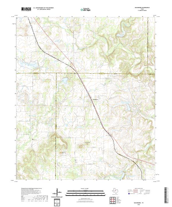
2022 Map of Goldsboro
USGS Topo · Published 2022About this map
Goldsboro centers this landscape in West Central Texas, situated at the crossroads of a complex creek network and the historic Abilene Coleman Rd. The terrain is defined by the prominent rises of Jim Ned Peak and Chandlers Peak, which overlook the watershed of Jim Ned Creek and its various tributaries like Honey Creek and Camp Branch. This 2022 survey illustrates a pastoral region where land management is visible through projects such as the Soil Conservation Service Site 12c Reservoir. For those researching family history in Coleman or Runnels counties, the map serves as a contemporary guide to the locations of Content Cemetery and Midway Cemetery, both of which remain as established landmarks within the rural grid of county roads and farm-to-market routes.
Find a feature on this map
50 named features on this map. Tap any name to fly to it.
Don’t see what you’re looking for? This feature index may not catch every label — zoom into the map to look around manually.
Map Details
Editions of this 2022 Goldsboro Map
This is the sole edition of this map. No revisions or reprints were ever made.
Other maps of this area

1890 · Abilene
USGS Topo · 1:125,000

1892 · Abilene
USGS Topo · 1:125,000

1892 · Ballinger
USGS Topo · 1:125,000

1954 · Brownwood
USGS Topo · 1:250,000

1954 · Abilene
USGS Topo · 1:250,000

1958 · Abilene
USGS Topo · 1:250,000

1967 · Novice West
USGS Topo · 1:24,000
1967 · Novice East
USGS Topo · 1:24,000

1967 · Tuscola
USGS Topo · 1:24,000
1967 · McEwen Draw
USGS Topo · 1:24,000