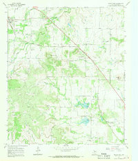
1967 Map of Novice East
USGS Topo · Published 1969About this map
Novice and Silver Valley anchor this mid-century Coleman County landscape, where the petroleum industry and cattle ranching shape the terrain. The Atchison Topeka and Santa Fe railroad cuts a diagonal path through the northern half of the sheet, providing a vital link for the Burroughs Oil Field and the numerous Oil Wells scattered across the limestone hills. Local history is preserved in several small burial grounds, including Rough Creek Cem and the Silver Valley Cem, which sit near the ephemeral waters of Rough Creek.
Find a feature on this map
25 named features on this map. Tap any name to fly to it.
Don’t see what you’re looking for? This feature index may not catch every label — zoom into the map to look around manually.
Map Details
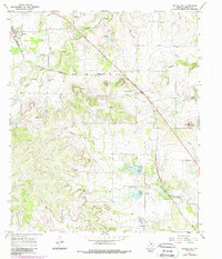
Editions of this 1967 Novice East Map
2 editions found
Other maps of this area

1887 · Coleman
USGS Topo · 1:125,000

1889 · Coleman
USGS Topo · 1:125,000

1890 · Abilene
USGS Topo · 1:125,000

1892 · Abilene
USGS Topo · 1:125,000

1892 · Ballinger
USGS Topo · 1:125,000

1931 · Baird
USGS Topo · 1:125,000

1932 · Baird
USGS Topo · 1:125,000

1954 · Brownwood
USGS Topo · 1:250,000

1954 · Abilene
USGS Topo · 1:250,000

1958 · Abilene
USGS Topo · 1:250,000