
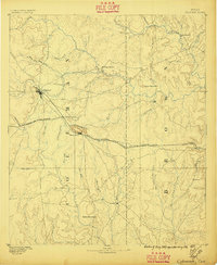
1887 Map of Coleman
USGS Topo · Published 1889About this map
The town of Coleman stands as a vital rail hub in Central Texas during the late nineteenth century, situated at the intersection of several overland wagon roads. The Gulf Colorado and Santa Fe Railroad cuts diagonally across the landscape, linking the county seat with Santa Anna and the small stop at Bangs. The presence of Camp Colorado north of Jim Ned Creek reflects the area's transition from a frontier outpost to an established agricultural and ranching district. Settlement is concentrated along the waterways, with small communities like Thrifty and Byrds Store appearing near Pecan Bayou. The terrain is defined by isolated elevations such as the Santa Anna Mountains and Speck Mountain, which provided natural landmarks for travelers before the expansion of the regional road network. This period shows the early development of Brown and Coleman counties when small trade centers like Cedarton and Trickham served rural farmsteads.
Find a feature on this map
43 named features on this map. Tap any name to fly to it.
Don’t see what you’re looking for? This feature index may not catch every label — zoom into the map to look around manually.
Map Details
Editions of this 1887 Coleman Map
2 editions found
Other maps of this area

1885 · San Saba
USGS Topo · 1:125,000

1889 · Brownwood
USGS Topo · 1:125,000

1889 · Coleman
USGS Topo · 1:125,000

1890 · Abilene
USGS Topo · 1:125,000

1892 · Eden
USGS Topo · 1:125,000

1892 · Abilene
USGS Topo · 1:125,000

1892 · Ballinger
USGS Topo · 1:125,000

1894 · Brady
USGS Topo · 1:125,000

1894 · Eastland
USGS Topo · 1:125,000

1894 · Brownwood
USGS Topo · 1:125,000