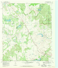
1967 Map of Goldsboro
USGS Topo · Published 1970About this map
The high plains of Central Texas converge at the intersection of Taylor, Runnels, Coleman, and Callahan counties, a region defined by its wide creek drainages and petroleum development in the late 1960s. The Atchison Topeka and Santa Fe railroad cuts a straight line through the landscape, passing the small settlement of Goldsboro and providing a vital link for the local economy. Water management is evident through features like Santa Fe Lake and numerous spillways along Buffalo Creek and Jim Ned Creek, reflecting the importance of water security in this semi-arid environment.
Find a feature on this map
33 named features on this map. Tap any name to fly to it.
Don’t see what you’re looking for? This feature index may not catch every label — zoom into the map to look around manually.
Map Details
Editions of this 1967 Goldsboro Map
This is the sole edition of this map. No revisions or reprints were ever made.
Other maps of this area

1890 · Abilene
USGS Topo · 1:125,000

1892 · Abilene
USGS Topo · 1:125,000

1892 · Ballinger
USGS Topo · 1:125,000

1954 · Brownwood
USGS Topo · 1:250,000

1954 · Abilene
USGS Topo · 1:250,000

1958 · Abilene
USGS Topo · 1:250,000

1967 · Novice West
USGS Topo · 1:24,000
1967 · Novice East
USGS Topo · 1:24,000

1967 · Tuscola
USGS Topo · 1:24,000
1967 · McEwen Draw
USGS Topo · 1:24,000