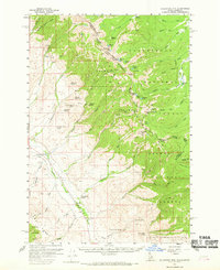
1956 Map of Goldstone Mtn
USGS Topo · Published 1969About this map
Continental Divide crests along the high ridges of the Beaverhead Mountains in the mid-1950s, defining the border between Idaho and Montana. This high-altitude landscape is marked by remote mining operations, including the Goldstone Mine and Jahnke Mine, which were established near high alpine lakes like Jahnke Lake and Swift Lake. The map reveals the infrastructure of early resource extraction and irrigation, noting several prospects, Tunnels, and a Siphon and Flume near the Lemhi River. In the valley, the Sandy Creek School serves the rural population near the small settlement of Baker, where the Overland Trail and a Jeep Trail trace the early transportation routes through the Lemhi Valley. The terrain shifts from the high peaks of Center Mtn and Goldstone Mtn down to the meadows of the Salmon National Forest and Beaverhead National Forest.
Find a feature on this map
74 named features on this map. Tap any name to fly to it.
Don’t see what you’re looking for? This feature index may not catch every label — zoom into the map to look around manually.
Map Details
Editions of this 1956 Goldstone Mtn Map
2 editions found
Other maps of this area

1950 · Salmon
USGS Topo · 1:62,500

1951 · Salmon
USGS Topo · 1:62,500

1955 · Dubois
USGS Topo · 1:250,000

1955 · Dillon
USGS Topo · 1:250,000

1956 · Goldstone Mtn
USGS Topo · 1:62,500

1956 · Lemhi
USGS Topo · 1:62,500

1957 · Dillon
USGS Topo · 1:250,000

1958 · Dubois
USGS Topo · 1:250,000

1958 · Dillon
USGS Topo · 1:250,000

1962 · Dillon
USGS Topo · 1:250,000