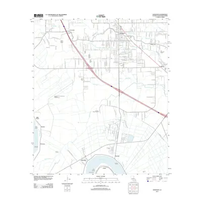
2012 Map of Gonzales
USGS Topo · Published 2012About this map
Gonzales and its surrounding river parishes are defined by the winding course of the Mississippi River and an intricate network of waterways like Bayou Francois and Bayou Conway. This 2012 landscape illustrates a complex transition from the industrial riverfront at Cofield and Burnside to the residential expansion of the city. Significant local history is preserved in several memorial sites, including the Saint Theresa of Avila Catholic Cem and the Hope Haven Mausoleum and Cem. The area's economic diversity is evident in the presence of the Darrow Oil Field, the Louisiana Regional Airport, and the large-scale Ascension Parish Comprehensive Wastewater Treatment Facility. Smaller settlements such as Hillaryville, Brittany, and Weber City dot the landscape, connected by a dense grid of rural roads and canals that reflect the region's agricultural and drainage history.
Find a feature on this map
190 named features on this map. Tap any name to fly to it.
Don’t see what you’re looking for? This feature index may not catch every label — zoom into the map to look around manually.
Map Details
Editions of this 2012 Gonzales Map
This is the sole edition of this map. No revisions or reprints were ever made.
Other maps of this area

1892 · Donaldsonville
USGS Topo · 1:62,500

1908 · Baton Rouge
USGS Topo · 1:62,500

1934 · Denham Springs
USGS Topo · 1:62,500

1935 · Gonzales
USGS Topo · 1:31,680

1936 · White Castle
USGS Topo · 1:62,500

1939 · Denham Springs
USGS Topo · 1:62,500

1939 · Baton Rouge
USGS Topo · 1:62,500

1939 · Donaldsonville
USGS Topo · 1:62,500

1946 · Convent
USGS Topo · 1:31,680

1947 · Donaldsonville
USGS Topo · 1:31,680