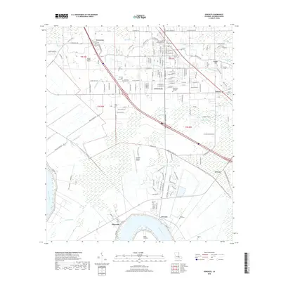
2018 Map of Gonzales
USGS Topo · Published 2018About this map
The city of Gonzales serves as a major hub within Ascension Parish, situated near a complex network of waterways including the New River, Bayou Narcisse, and the Panama Canal. This landscape is defined by its transition from the developed urban corridors of Cornerview and Weber City to the low-lying wetlands surrounding the Mississippi River at Point Houmas. The presence of numerous historical burial sites, such as the Hope Haven Mausoleum and Cem and the Orange Grove Cem, highlights the long-established communities that have thrived between these bayous for generations.
Find a feature on this map
82 named features on this map. Tap any name to fly to it.
Don’t see what you’re looking for? This feature index may not catch every label — zoom into the map to look around manually.
Map Details
Editions of this 2018 Gonzales Map
This is the sole edition of this map. No revisions or reprints were ever made.
Other maps of this area

1892 · Donaldsonville
USGS Topo · 1:62,500

1908 · Baton Rouge
USGS Topo · 1:62,500

1934 · Denham Springs
USGS Topo · 1:62,500

1935 · Gonzales
USGS Topo · 1:31,680

1936 · White Castle
USGS Topo · 1:62,500

1939 · Denham Springs
USGS Topo · 1:62,500

1939 · Baton Rouge
USGS Topo · 1:62,500

1939 · Donaldsonville
USGS Topo · 1:62,500

1946 · Convent
USGS Topo · 1:31,680

1947 · Donaldsonville
USGS Topo · 1:31,680