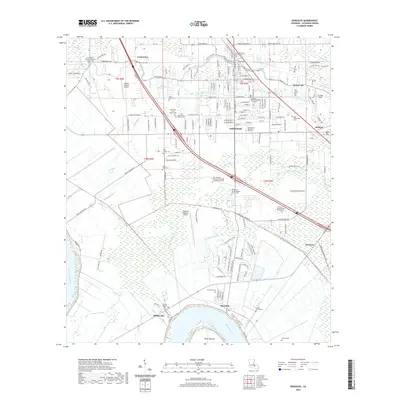
2020 Map of Gonzales
USGS Topo · Published 2020About this map
Gonzales and the surrounding Ascension Parish landscape are defined by the winding course of the Mississippi River and an intricate network of waterways like the New River, Bayou Francois, and the Panama Canal. This area reflects a deep-rooted community history, visible through the high density of religious and family burial sites, including the Saint Theresa of Avila Catholic Cem and the Hope Haven Mausoleum and Cem. The terrain transitions from the river’s edge at Point Houmas toward the developed centers of Burnside, Sorrento, and Hillaryville.
Find a feature on this map
163 named features on this map. Tap any name to fly to it.
Don’t see what you’re looking for? This feature index may not catch every label — zoom into the map to look around manually.
Map Details
Editions of this 2020 Gonzales Map
This is the sole edition of this map. No revisions or reprints were ever made.
Other maps of this area

1892 · Donaldsonville
USGS Topo · 1:62,500

1908 · Baton Rouge
USGS Topo · 1:62,500

1934 · Denham Springs
USGS Topo · 1:62,500

1935 · Gonzales
USGS Topo · 1:31,680

1936 · White Castle
USGS Topo · 1:62,500

1939 · Denham Springs
USGS Topo · 1:62,500

1939 · Baton Rouge
USGS Topo · 1:62,500

1939 · Donaldsonville
USGS Topo · 1:62,500

1946 · Convent
USGS Topo · 1:31,680

1947 · Donaldsonville
USGS Topo · 1:31,680