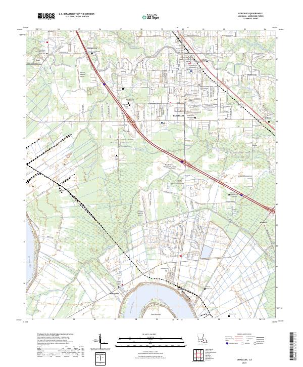
2024 Map of Gonzales
USGS Topo · Published 2024About this map
Gonzales serves as a significant regional hub where the historical waterways of the Louisiana bayous meet modern industrial and residential expansion. The town is anchored by the Ascension Parish Courthouse, with older residential patterns still visible along W New River Exd and E New River St. The landscape is defined by its complex drainage network, including the winding New River and Bayou Francois, which eventually give way to the engineered Panama Canal and the wide bend of the Mississippi River at Point Houmas.
Find a feature on this map
110 named features on this map. Tap any name to fly to it.
Don’t see what you’re looking for? This feature index may not catch every label — zoom into the map to look around manually.
Map Details
Editions of this 2024 Gonzales Map
This is the sole edition of this map. No revisions or reprints were ever made.
Other maps of this area

1892 · Donaldsonville
USGS Topo · 1:62,500

1908 · Baton Rouge
USGS Topo · 1:62,500

1934 · Denham Springs
USGS Topo · 1:62,500

1935 · Gonzales
USGS Topo · 1:31,680

1936 · White Castle
USGS Topo · 1:62,500

1939 · Denham Springs
USGS Topo · 1:62,500

1939 · Baton Rouge
USGS Topo · 1:62,500

1939 · Donaldsonville
USGS Topo · 1:62,500

1946 · Convent
USGS Topo · 1:31,680

1947 · Donaldsonville
USGS Topo · 1:31,680